
Exploring Puerto Williams: A Hidden Gem at the Edge of the World
Walking along the icy banks of the Ukika River, the crunch of frozen ground beneath my boots echoes in the otherwise quiet landscape. The dense southern beech forest surrounding me is alive with clusters of orange fungi, round like golf balls, dotting the forest floor. The trees are covered with tiny mosses, liverworts, and hornworts, creating a mini ecosystem, while the air is thick with wispy strands of lichen known as “old man’s beard,” swaying in the gusty wind. The path ahead twists with fallen logs and gnarled tree roots, and above me, the wind shakes the treetops, filling the air with eerie creaking sounds. In the distance, I can hear the rhythmic tapping of a Magellanic woodpecker, its bright red head hidden somewhere above.
The Journey to the End of the World

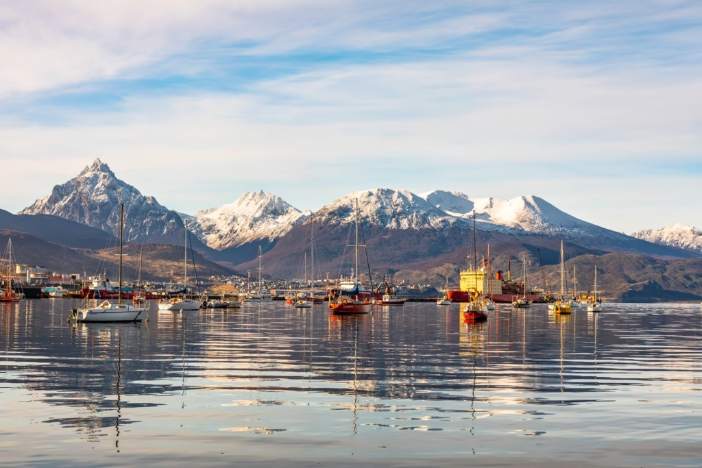
Leaving behind the peaceful Parque Municipal Ukika, I watch as the Ukika River flows into the Beagle Channel—its steel-gray waters stretching as far as the eye can see. This waterway, which winds through Tierra del Fuego, connects the Atlantic and Pacific Oceans. To my right is Villa Ukika, a small Indigenous Yahgan community. On my left, I catch my first glimpse of Puerto Williams, the southernmost city on Earth.
Tierra del Fuego is a land of islands, islets, cliffs, and peninsulas, where towering glaciers and lush green forests cover the landscape. The area is known as the “Land of Fire,” a name given to it by Portuguese explorer Ferdinand Magellan in 1520, who spotted the bonfires of the Selk’nam people. This remote region, shared by Argentina and Chile, remains largely wild, though increasing numbers of tourists visit Ushuaia, the largest city in Tierra del Fuego, which has become a popular starting point for Antarctic cruises.
Puerto Williams: The Remote Charm of Chile’s Southernmost City
Yet, few travelers venture further south across the Beagle Channel to reach Chile’s Puerto Williams, located on Navarino Island. In 2019, this 2,800-person settlement was officially designated as a city, though it remains 1,500 miles from Santiago and just 670 miles from Antarctica. Getting here isn’t easy—it requires either a flight or a boat trip, and that remoteness only adds to the area’s charm.
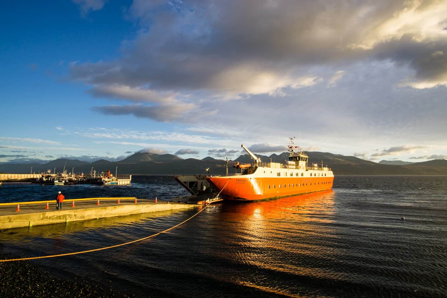
On my first visit to Puerto Williams before the pandemic, I took the scenic, but long, route: a bus from Punta Arenas, a ferry across the Strait of Magellan, and then a long drive through Argentina’s Tierra del Fuego to Ushuaia. The next day, I took a boat across the Beagle Channel, passing sea lion colonies on rocky islands, to reach Puerto Navarino, followed by a minibus ride to Puerto Williams.
This time, I opt for a quicker 30-minute flight from Punta Arenas, with breathtaking views of the snow-capped peaks of Alberto de Agostini National Park—a place Charles Darwin marveled at in his Voyage of the Beagle, where he described the majestic glaciers and breaching whales he encountered.
Puerto Williams: A Slice of Remote Tranquility

Puerto Williams sits at the southern edge of the Beagle Channel, nestled beneath the jagged peaks of the Dientes de Navarino mountains. Despite being Chile’s Antarctic Province capital, it feels like a small, peaceful town. Founded as a naval base in the 1950s, Puerto Williams features neat white houses for military families, civilian homes with satellite dishes and piles of firewood, and a few shaggy dogs roaming the streets.
I walk through the quiet, windblown streets, passing a few closed shops, wooden churches, municipal buildings, and a school. Cows and horses graze in fields dotted with daisies, and the local residents live in such a way that the doors of their homes often remain unlocked—crime is nearly unheard of here. At a boardwalk overlooking the Beagle Channel, I watch as storm petrels circle above fishing boats pulling in king crabs, their hard work reflected in the bustling atmosphere of the small port.
Exploring Yahgan Heritage
That evening, I dine on freshly caught king crabs at a nautical-themed restaurant, then chat with Anna Baldinger, the owner of Hotel Fio Fio, where I’m staying. Originally from Austria, Anna moved to Puerto Williams to teach, then fell in love with both the island and a local man. “Puerto Williams is like a bubble—a village at the end of the world,” she says with a smile.
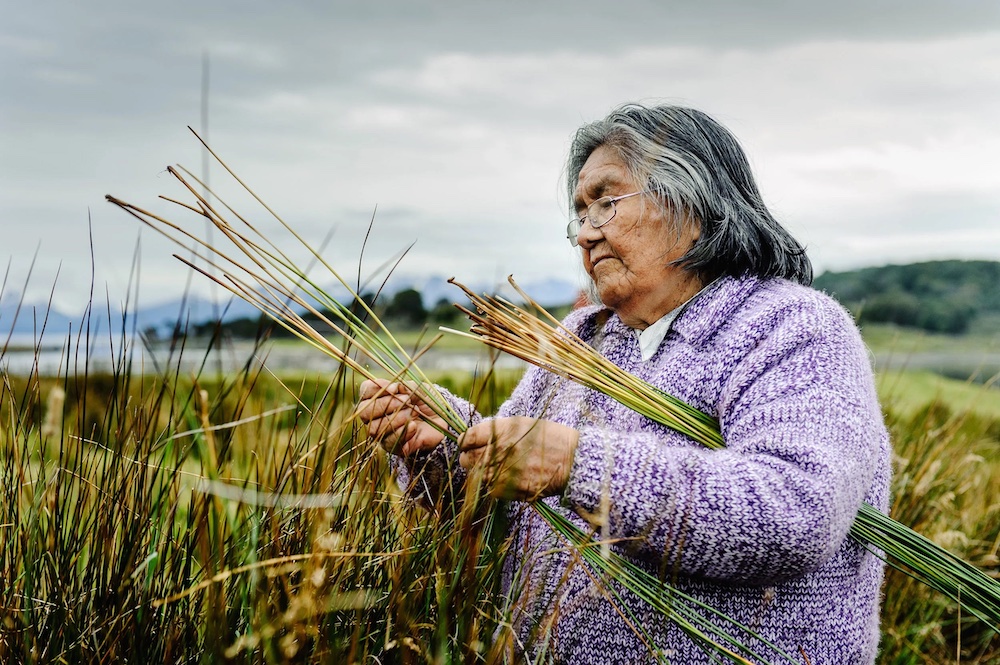
Despite being a relatively young city, Puerto Williams sits on land where the Yahgan people have lived for millennia. The island is rich in archaeological sites, with middens (ancient trash heaps) and circular depressions from old shelters scattered throughout. According to Maurice Van de Maele, an anthropologist and hotel owner, Navarino Island is home to up to 2,000 such sites, many of which are visible during a drive through the island.
Maurice, a former director of the town’s museum, Museo Territorial Yagan Usi – Martín González Calderón, shows me around. The museum itself is housed in a building decorated with a sun-bleached whale skeleton. Inside, exhibits include intricately made bone harpoons, jewelry, and canoes. The museum also recounts the tragic history of colonization, detailing the destruction of Indigenous communities by missionaries, gold miners, and ranchers during the 19th and 20th centuries.
Timeless Yet Changing

Although Tierra del Fuego feels timeless, changes are happening. On my visit, there are only a handful of tourists—mostly hikers, birdwatchers, and fishermen—looking to experience the “end of the world.” However, Antarctic cruise ships are arriving more frequently, bringing hundreds of visitors at a time, clad in matching jackets. In response, a new dock is being built to accommodate larger ships, and there are plans for a new hotel and an upgraded airport.
A Landscape on the Verge of Development

Road projects are also changing the landscape of Tierra del Fuego. The southernmost road in Chile, the Y-905, ends just north of Villa Ukika, but plans are in place to extend it all the way to Puerto Toro, the southernmost inhabited settlement on the planet. Additionally, a new Sub-Antarctic Research Center is being constructed at Cape Horn, its sleek, spaceship-like design standing in stark contrast to the rugged terrain.
Yet, as I hike west from Puerto Williams, the concerns about overdevelopment fade away. The trail up Cerro Bandera—the first part of the famous 33-mile Dientes de Navarino circuit—winds through beech trees before opening up to the tundra, battered by the wind. At the summit, a Chilean flag flutters fiercely in the gusts, and the panoramic view stretches over the Beagle Channel, with snow-capped peaks rising above a glacial lake.
The wind is biting, and the sleet stings my face, but I can’t help but smile. I remember Anna’s words: “When you stand atop Cerro Bandera’s peak, no one is in front of you. The rest of the world is far, far away.”
FAQs About Visiting Puerto Williams and Tierra del Fuego
1. What is the best way to get to Puerto Williams?
You can either take a flight from Punta Arenas, Chile, or a boat across the Beagle Channel. Both offer spectacular views of the surrounding landscapes.
2. When is the best time to visit Puerto Williams?
Summer (December to March) is the best time to visit, as the weather is milder, and the region is more accessible. However, for those seeking solitude, winter offers a peaceful and less crowded experience.
3. What should I expect in terms of accommodations?
Puerto Williams has a small number of accommodations, mostly guesthouses and small hotels. One notable option is Hotel Fio Fio, run by Anna Baldinger.
4. Can I go hiking in Puerto Williams?
Yes, there are multiple hiking trails around Puerto Williams, including the famous Dientes de Navarino circuit, which offers breathtaking views of the mountains and the Beagle Channel.
5. What is the significance of the Yahgan people in Puerto Williams?
The Yahgan people have lived in this region for thousands of years. Many archaeological sites remain on Navarino Island, offering insight into the history and culture of the Indigenous people.
6. Is there any risk of overdevelopment in Puerto Williams?
There are plans to build a new dock and improve the airport to accommodate more tourists, but the region still maintains a tranquil, untouched atmosphere despite these changes.
7. What wildlife can I see in Puerto Williams?
Puerto Williams is home to a variety of wildlife, including sea lions, storm petrels, and a range of bird species. You may also encounter mule deer and black bears in the surrounding forests.
Conclusion: A Remote Paradise in the “End of the World”
Puerto Williams, situated at the southern tip of the world, offers a peaceful, remote escape from the modern world. With its rich Indigenous heritage, stunning natural beauty, and growing tourist interest, it’s a destination that promises adventure, solitude, and a glimpse into the world’s last frontiers. Whether you’re hiking the Dientes de Navarino circuit or learning about the Yahgan culture, Puerto Williams is a place that will stay with you long after you leave.